A historic weather front that slammed a wide swath of Southern California with stunning snow, record rains, and flooding that prompted air rescues eased its grip Sunday — but more harsh weather is expected this week across the state.
The first of two new storms brought rain and snow Sunday to northern California. Blizzard warnings will go into effect at 4 a.m. Monday and will last until Wednesday for much of the Sierra Nevada.
“Extremely dangerous and near to impossible mountain travel is expected due to heavy snow and strong wind,” the weather service’s Sacramento office warned on Twitter.
The snow won’t sweep down to the edge of coastal cities as it did in recent days, but this week’s forecast for Los Angeles does call for high temperatures in the low 50s — about 15 degrees below normal.
More than 61,500 homes and businesses in the state remained without power Sunday afternoon after days of fierce winds, rains, and snow that toppled trees and downed power lines.
“A remarkable storm the last few days with historic amounts of precip and snow down to elevations that rarely see snow,” forecasters with the weather service in Los Angeles wrote.
Meteorologist Mark Moede said the winter storm would “exit Southern California this morning and there will be a brief break in the weather” but that rain and mountain snow is expected to return Monday through Wednesday.
Meanwhile, millions of Americans were also bracing for dangerous conditions, from ice storms in Michigan to tornadoes in Texas.
Developments:
• More than 7 inches of rain fell in Ventura County northwest of Los Angeles, causing flash flooding that left cars stranded on roadways Saturday.
• Los Angeles Fire Department ground and air responders rescued four people and five animals from flooding in Encino, California, about 25 miles northwest of downtown Los Angeles.
• At the storm’s peak, up to 10 inches of rain fell in lower elevations and some mountain areas were blasted with more than 5 feet of snow.
A BLIZZARD IN SOUTHERN CALIFORNIA:What to know about weird weather.
Michigan struggles with outages, braces for next storm
More than 217,000 homes and businesses remained in the dark across southeast Michigan on Sunday night days after storms knocked out power to close to 1 million customers. The utilities that serve the area said they hope to restore electricity to the majority of affected customers by night’s end.
Another round of severe weather could be headed to the region Monday.
The weather service said the “potential continues” for strong wind gusts accompanied by sleet, freezing rain, and potentially heavy snowfall. The weather service in Grand Rapids, Michigan, warned that more power outages were possible and commutes could be messy.
“Bad: Additional freezing rain & ice accumulation expected Monday,” the weather service tweeted. “Good: Accumulations should be less and stay north of ice storm impacted areas.”

Tornado confirmed in Oklahoma
High wind watches and warnings extended to more than 60 million Americans from Ohio to New Mexico. An extensive swath of severe thunderstorms that could fuel winds in excess of 75 mph was expected to slam the eastern Texas Panhandle across parts of Oklahoma to the western Ozarks region.
“A derecho is forecast with widespread damaging winds and embedded swaths of significant severe gusts,” said Roger Edwards, a forecaster with the weather service’s Storm Prediction Center. Derechos carry high winds and move fast in a straight line.
Edwards added that a few tornadoes also are possible “with potential for significant/EF2+ damage.” EF2 tornadoes drive winds of up to 135 mph.
Meanwhile, warning sirens were heard in Oklahoma City late Sunday as dangerous winds entered the city. The National Weather Service in Norman confirmed a tornado between Lone Wolf, Oklahoma, and Hobart, Oklahoma.
The city urged residents to take immediate shelter upon hearing a siren and to get more information about the storm.
Snow stuns residents of some California cities
A mix of warm atmospheric river air and cold air from Alaska conspired to bring a dusting of snow to high desert areas of Southern California valleys Saturday, according to the National Weather Service.
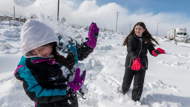
Rare snow fell Saturday in Rancho Cucamonga and Fontana in San Bernardino County. With snow reaching down from the mountains to as low as 1,000 feet, the hills around Santa Clarita, north of Los Angeles, were white. Snow also surprised residents of inland suburbs.
Some parts of the high desert saw more than a foot of snow.
As snow blanketed the communities of Pinon Hills and Phelan in San Bernardino County, some residents were seen trudging through the thick snow. Others took advantage of the rare event and sled down the white hills.
“Areas in the Inland Empire near Fontana, Rialto, and Devore have now picked up more snow this winter than New York City and Philadelphia,” the National Weather Service in San Diego said Saturday.
In the mountains, the University of California, Berkeley, Central Sierra Snow Lab said the four-day total near Donner Summit in the Sierra Nevada had reached more than 56 inches.
“Snow will pickup again tomorrow with several substantial storms expected to drop another 5-10 feet through Weds!” the lab tweeted.
Los Angeles sees more than 2 inches of rain in one day
Downtown Los Angeles saw 2.29 inches of rain Friday, making it the wettest February day in 20 years, AccuWeather reported. The single-day rainfall was more than 20 times greater than the total rainfall from the past three Februarys, which combined for only 0.10 of an inch.
In Santa Clarita’s Valencia neighborhood, about 35 miles northwest of Los Angeles, county officials said the heavy rains eroded an embankment at an RV park and swept multiple motorhomes into the Santa Clara River. Video showed one of the RVs toppled on its side and a large tree falling into the river. A representative from the RV park said no one was injured.
“I was just kinda taken aback by the way people didn’t take heed that the water was going to be coming in as strong as it did,” resident Edwin Dockus
California chill extends east to nearby states
It’s not only California that’s dealing with unusually chilly weather as March approaches.
The notion of toasty spring training games in Arizona and a comfortable stroll down The Strip in Las Vegas is taking a hit this year as Pacific storms from the north make their way east.
High temperatures won’t climb above 65 degrees until Saturday in Phoenix, the heart of the 15-team Cactus League that serves as an escape from the cold for thousands of baseball fans every year.
Las Vegas, another desert city often blessed with plenty of sunshine, is expecting to greet the arrival of March on Wednesday with rain and a high of 49 before climbing into the 60s on Saturday.
By then, Los Angeles residents will be able to shed the parkas but not the sweaters as the mercury will only reach 65 degrees because of a new cold front that figures to keep temperatures well below the norm several days into March.
Contributing: Josh Dulaney, The Oklahoman; Eric Woomer, Victorville Daily Press; The Associated Press


