After rapidly overflowing its banks and pouring into homes and businesses along its upper reaches, the Mississippi River has crested in much of the Upper Midwest, easing fears of a record disaster, even though major flooding is forecast to continue in the region through mid-May.
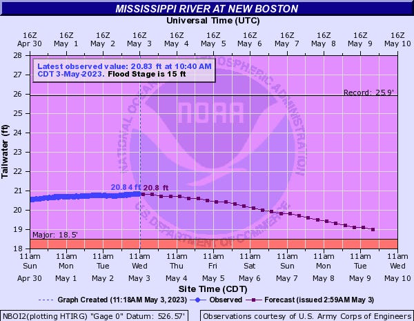
The river was peaking Wednesday at Dam 17, just north of New Boston, Illinois, said Mike Welvaert, a service coordination hydrologist with the North Central River Forecast Center. “We’re looking for the crest between Keokuk (Iowa) and St. Louis over the next two to three days.”
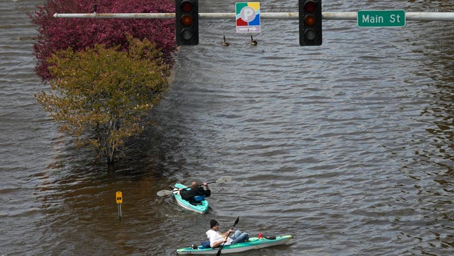
Because major flooding remains along the river in many areas, the weather service warns residents not to enter flooded waters – “hidden debris that the flood has picked up along the way can cause serious injury and/or trap you under the water with strong currents.”
How does climate change affect you?Subscribe to the weekly Climate Point newsletter
READ MORE:Latest climate change news from USA TODAY
Forecasts call for little rain in the coming ten days, so the river is expected to begin a slow decline.
Why is the Mississippi River flooding?
Record-setting snow fell in Minnesota and northern Wisconsin over the winter.
Then in early April, “we had a pretty rapid and extreme warmup in the Upper Midwest,” Welvaert said. “It melted all that snow really quickly. That’s what drove the river rises in the Mississippi and its tributaries.”
Portions of the upper Mississippi also received above normal rainfall in April, as much as 4 inches above normal, said the LaCrosse, Wisconsin, weather service office.
As a result:
- The river reached its highest levels since 2001
- Upstream of Dubuque, Iowa, the river reached one of its top three flood levels, dating back to the 1800s
- However, the peak crest of 22.83 feet was nearly three feet below the record
- Most sites saw a top 5 crest
It was a dramatic turn of events, after portions of the river reached their shallowest levels in 10 years in October.
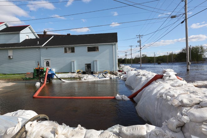
As residents worked to protect cities and homes, sandbags were stacked high in areas along the river. Water poured into homes and streets in Wisconsin, including in La Crosse and Fountain City.
Iowa’s Governor Kim Reynolds declared an emergency for counties along the Mississippi to coordinate the state’s response and relief activities.
But thanks to improved floodwalls and other prevention measures, the river crest was not as high as had been feared in cities like Davenport, Iowa.
The river’s recent crest at Davenport of 21.4 feet was slightly lower than the 21.6 feet predicted for the Quad-Cities area, said weather service meteorologist Matt Wilson.
“Everybody’s plan along the river has been put to the test and everybody is passing right now,” Wilson said.

What happens next along the Mississippi?
The flooding is expected to ease as the spring surge from melting snow works its way further down the 2,300-mile length of the river on its way to the Gulf of Mexico.
Southward along the Mississippi, other areas of the watershed did not have record snow, so other tributaries along the river aren’t contributing a lot of extra water, Welvaert said. “So the impact of this water coming down the Mississippi is really going to be lessened by the time it gets to St. Louis.
The weather service office in La Crosse said it will take until around May 10th (a little earlier for northern sites, a little later for southern sites) for most sites to fall below flood stage, and another week from there for the river to fall back within its banks.

What does ‘flood stage’ mean? And what’s the difference between moderate and major flooding?

The weather service issues flood warnings when it expects moderate and major flooding — and it has done so all along the Mississippi River in the Upper Midwest this week. It uses a handful of terms to define how severe flooding could get. It can vary from location to location; it depends less on the river’s level relative to its banks and more on the river’s threat to the public.
- Flood stage: the level where rising water can become hazardous to people or property
- Within flood stage, the weather service defines three categories: “minor,” “moderate” or “major.”
- Minor flooding is “inconvenience or nuisance flooding,” spilling into yards but not yet flooding buildings.
- Moderate flooding causes some roads and buildings near the river to be flooded, potentially causing evacuations.
- Major flooding is more extensive, shutting down roads and leading to significant evacuations.
Contributing: Tim Webber, The Des Moines Register; The Associated Press


