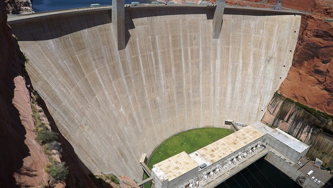
Historic snowfall across the Rocky Mountains is helping recharge some of the country’s biggest reservoirs and provide – briefly – some much-needed breathing room for the oversubscribed Colorado River.
Forecasts say the melting snow flowing into Lake Powell via the Colorado River and its tributaries could hit 177% of average this year, a major boost at a time when lake levels had hit historic lows. The levels are now headed up and will likely peak sometime in June, raising the surface by 50 feet.
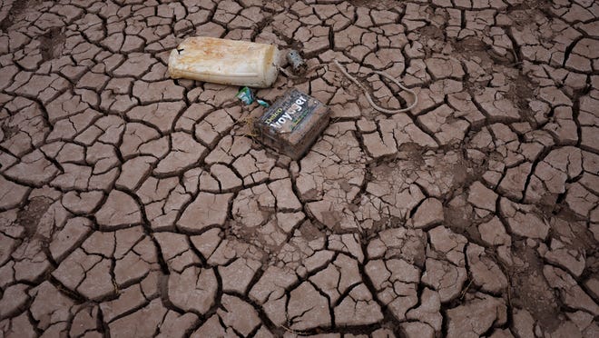
But experts say the boost won’t solve or even significantly delay the West’s water crisis that has drained the massive Lake Powell and Lake Mead reservoirs – Lake Powell will probably only be about 40% full this fall, far below what it once held.
“This buys a year,” longtime Colorado River expert Brad Udall said. “It doesn’t remotely come close to solving the long-term problems.”
How does climate change affect you?: Subscribe to the weekly Climate Point newsletter
READ MORE: Latest climate change news from USA TODAY
Meanwhile, at Lake Powell this week, authorities released billions of gallons of water downstream through the Grand Canyon as part of an attempt to rebuild beaches and create new fish habitats. It’s a long-planned experiment that might have been halted if water levels in the reservoir had kept dropping.
What does the Colorado River snowpack look like?
The Upper Colorado Basin’s snowpack stands at almost 160% above normal, meaning there’s a significant amount of water that will melt and flow downstream into the river. Some of that water will be lost through evaporation or absorption into the dry soils, however.
Colorado’s snowpack is well above average, and Utah had its snowiest winter on record.
“This winter’s snowpack is promising and provides us the opportunity to help replenish Lakes Mead and Powell in the near-term – but the reality is that drought conditions in the Colorado River Basin have been more than two decades in the making,” said Bureau of Reclamation Commissioner Camille Calimlim Touton in a statement.
Climate Point: Feds make moves on water crisis, pollution
DESPERATE WATER CRISIS IDEAS:Drain the Great Lakes, desalinate ocean water
Water managers hope to refill some of their smaller reservoirs in Colorado and Wyoming, which they have been draining in previous years to prop up Powell and Mead and prevent them from dropping below the levels necessary to produce hydroelectricity.
But overall, Colorado River flows have declined about 20% compared to historic flows, even with this year’s record-breaking snowfall.

What are the projections for Lake Powell and Lake Mead levels?
Authorities predict that Lake Powell will end 2023 at 3,573 above sea level, which is an clear improvement over the past several years. Last year it ended the year at 3,524 feet. Lake Mead ended 2022 at around 1,044 feet, and authorities predict it will end this year at about 1,068 feet.
Lake Powell’s official full level is 3,700 feet, and it topped out at 3,708 feet in 1983. That same year Mead hit 100% full at 1,225 feet. At their lowest, Powell was just 23% full, while Mead dropped to 28%.
Because the reservoirs are shaped like martini glasses, they hold significantly more water when they’re closer to full. Combined, they are today only about 26% full.
UN REPORT:‘We have already lost’ in 2 key climate change signals
NEWS:Spring ocean temperatures are shockingly hot around the globe. Scientists aren’t sure what happens next.
Experts don’t expect them to ever be full again, however – the ongoing question is how to manage what water they do have for the benefit of as many Americans as possible. Federal officials have rejected suggestions that they remove either the Glen Canyon or Hoover Dam and consolidate the water into just one reservoir.
Projections suggest Lake Powell’s level on Oct. 1 – the official start to what’s known as the water year – will be nearly 50 feet higher than it was a year ago. Lake Mead could be around 22 feet higher than it was last Oct. 1, although still about 160 feet below full.

What’s the long-term outlook for the Colorado River?
Udall, who studies the river at Colorado State University’s Colorado Water Center, said this winter’s snow is likely an aberration, and that long-term trends show the West is getting drier due to climate change. He said the only real solution is to use less water.
Big snow years are happening half as often as they used to, while dry years are happening 2.5 times as often, he said.
“There’s two important components to get to a better place,” he said. “The first is wishing for high flow years and the other is cutting demand. And we only control one of them.”
Federal officials are currently developing a plan that would force the seven states and Native American tribes using Colorado River water to use less of it. The exact details are being worked out but could lead to significant cuts in both California and Arizona, which depend heavily on the river to irrigate crops from alfalfa to almonds, along with many of the vegetables Americans eat, especially in the winter.


