Advertisement
Southeast Louisiana is expected to see severe weather later today and tonight. The biggest threat to prepare for is possible strong winds and tornadoes. All of Southeast Louisiana is under a Tornado Watch until 9 p.m. The Storm Prediction Center now has the region under levels 3, and 4 out of 5 for potential risks for severe thunderstorms, or, ‘enhanced’ and ‘moderate’ risks for severe storms. Just like last Tuesday, this means we’re looking at “widespread, intense, and long-lived storms.” Unfortunately, the tornado risk is on the high end of our risk scale. The SPC has specifically outlined parts of Southeast Louisiana under 10% and 15% chances of a tornado. I know that risk sounds low, but it means if you’re in that defined area, within 25 miles of you there’s a 10% or 15% chance of a tornado that could cause harm or worse. Again, this is the same threat level that was in place for the Arabi tornado that occurred last week.Click here to view our interactive radar. Here’s the setup. A strong cold front will start to move into the region from the west tapping into very warm and humid air while the wind structure is also favorable for a spin that could produce tornadoes and aid in an additional lift in the atmosphere. The timing of these storms to arrive in Southeast Louisiana still looks to be between the hours of 3 to 10 p.m.Click here for directions on how to sign up for severe weather alerts. Here are the most up-to-date arrival times of the thunderstorms to where you are:What types of severe weather are we looking at? The greatest risk, is still from destructive winds, possibly as strong as over 70 mph. The second-highest threat looks to come from the potential of tornadoes either from lone storms ahead of the mainline, spin-up variety tornadoes on the leading edge of the strong winds gusting out from the primary storm line and embedded supercells within the line of storms. If tornadoes are to occur, some could be intense in nature of EF-2 strength or higher. Localized flooding is also possible where the Weather Prediction Center (WPC) has placed parts of the Northshore under a Level 1 risk of flooding.Click here for hourly and extended forecasts.Very strong winds will also precede the arrival of the storms as well, where we’re most likely to be placed under a Wind Advisory for south winds at 20-30 mph with gusts possibly towards 45 mph.While this risk looks a lot like the risk we had last week, there are some slight differences. Looking at the energy in the atmosphere, we can measure convective available potential energy as a gauge for how much rapid rising motion the storms could have. Last week’s environment forecast amounts on the order of 1500 joules per kilogram of air while this week’s forecast calls for well under 1,000 joules per kilogram of air. Also, the winds at ground level were more from the southeast while the winds this week will be more due south.Finally, the big similarity will come from the winds higher up in the air where we say this “wind profile” looks similar to the event on Tuesday where the strongest winds up a few miles into the air originate from the southwest and are as strong as 150 mph or more.So, what’s the takeaway? We should prepare for severe storms and even for the risk of tornadoes. However, the greatest risk looks to be just north and west of Southeast Louisiana.As with every storm, keep checking in with WDSU online and on-air for all the latest on this situation.
Southeast Louisiana is expected to see severe weather later today and tonight. The biggest threat to prepare for is possible strong winds and tornadoes.
All of Southeast Louisiana is under a Tornado Watch until 9 p.m.
The Storm Prediction Center now has the region under levels 3, and 4 out of 5 for potential risks for severe thunderstorms, or, ‘enhanced’ and ‘moderate’ risks for severe storms.
Just like last Tuesday, this means we’re looking at “widespread, intense, and long-lived storms.” Unfortunately, the tornado risk is on the high end of our risk scale. The SPC has specifically outlined parts of Southeast Louisiana under 10% and 15% chances of a tornado. I know that risk sounds low, but it means if you’re in that defined area, within 25 miles of you there’s a 10% or 15% chance of a tornado that could cause harm or worse. Again, this is the same threat level that was in place for the Arabi tornado that occurred last week.
Click here to view our interactive radar.
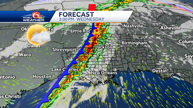
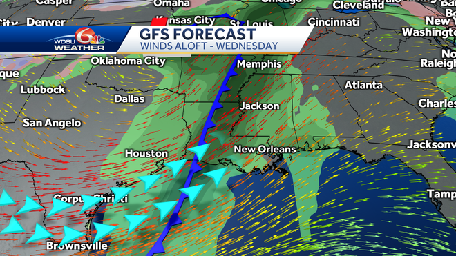
Here’s the setup. A strong cold front will start to move into the region from the west tapping into very warm and humid air while the wind structure is also favorable for a spin that could produce tornadoes and aid in an additional lift in the atmosphere. The timing of these storms to arrive in Southeast Louisiana still looks to be between the hours of 3 to 10 p.m.
Click here for directions on how to sign up for severe weather alerts.
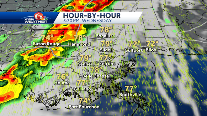
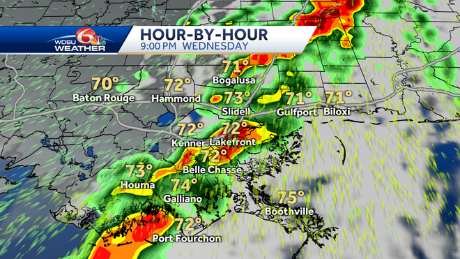
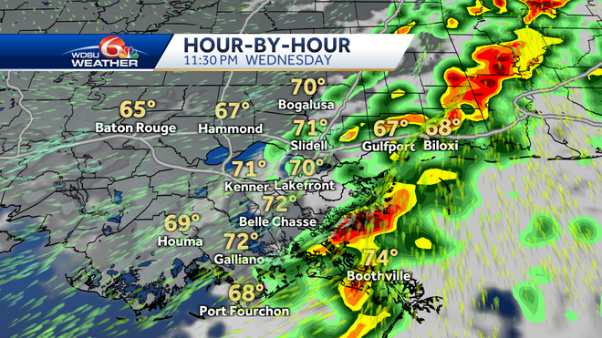
Here are the most up-to-date arrival times of the thunderstorms to where you are:
What types of severe weather are we looking at? The greatest risk, is still from destructive winds, possibly as strong as over 70 mph. The second-highest threat looks to come from the potential of tornadoes either from lone storms ahead of the mainline, spin-up variety tornadoes on the leading edge of the strong winds gusting out from the primary storm line and embedded supercells within the line of storms. If tornadoes are to occur, some could be intense in nature of EF-2 strength or higher. Localized flooding is also possible where the Weather Prediction Center (WPC) has placed parts of the Northshore under a Level 1 risk of flooding.
Click here for hourly and extended forecasts.
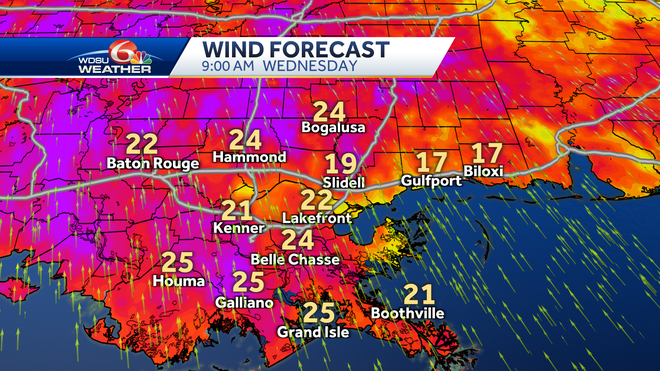
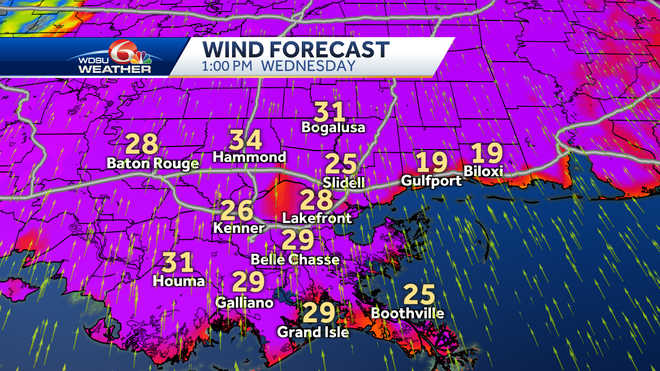
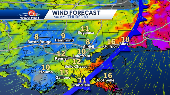
Very strong winds will also precede the arrival of the storms as well, where we’re most likely to be placed under a Wind Advisory for south winds at 20-30 mph with gusts possibly towards 45 mph.
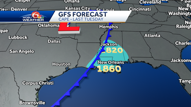
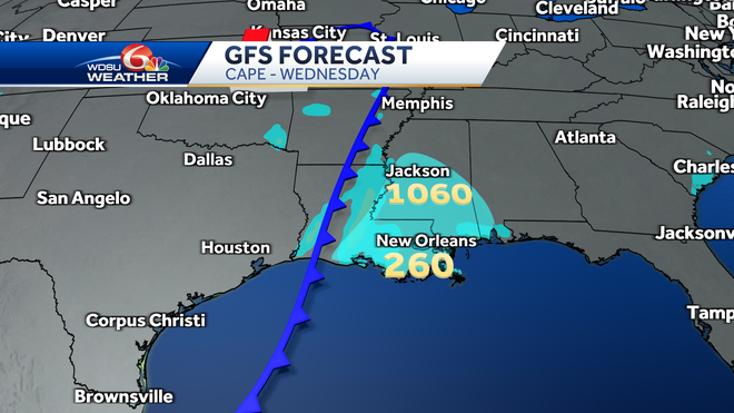
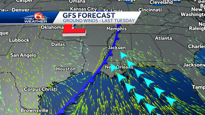
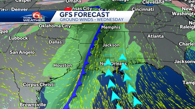
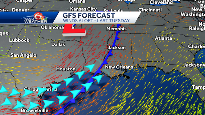
While this risk looks a lot like the risk we had last week, there are some slight differences. Looking at the energy in the atmosphere, we can measure convective available potential energy as a gauge for how much rapid rising motion the storms could have. Last week’s environment forecast amounts on the order of 1500 joules per kilogram of air while this week’s forecast calls for well under 1,000 joules per kilogram of air.
So, what’s the takeaway? We should prepare for severe storms and even for the risk of tornadoes. However, the greatest risk looks to be just north and west of Southeast Louisiana.
As with every storm, keep checking in with WDSU online and on-air for all the latest on this situation.


