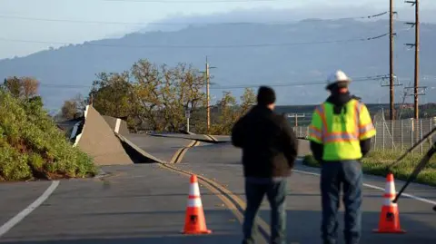
A storm developing off the coast of the US northwest is forecast to bring high winds, flooding and snow to over seven million residents living in states along the Pacific Ocean.
It started impacting the region Tuesday and is expected to worsen through the end of the week, according to the National Oceanic and Atmospheric Administration (NOAA).
Beyond wind, rain and snow, the storm could also bring flash flooding, rock slides and debris flows as well as heavy mountain snow and blizzard conditions in areas of high elevation.
The “bomb cyclone” – as forecasters call it – is caused by air pressure quickly dropping off the coast, which has rapidly intensified the weather system.
 Getty Images
When and where will it hit?
Parts of the northwest are already starting to feel impacts from the storm, with strong wind gusts already observed in the Seattle area.
NOAA’s weather prediction centre said the storm is expected to bring heavy, wet snow to mountain ranges in the Pacific Northwest with accumulation rates of 2-3in (5-8cm) per hour and wind up to 65 mph (29mps).
The weather could bring whiteout conditions that will make travel difficult, according to NOAA. There could be 10-20in (25-50cm) of snow in spots.
Wind gusts could bring power outages, downed trees and high surf along the coastline, the US weather agency said, which issued a “high risk excessive rainfall outlook” for northwest California.
The heaviest rainfall – which could bring mud slides – is expected to hit northern California and southwest Oregon, according to the NOAA.
The National Weather Service also issued winter weather alerts and a winter storm warning through Wednesday for several other areas along the Pacific coast.
“Numerous flash floods, hazardous travel, power outages, and tree damage can be expected as the storm reaches max intensity,” the National Weather Prediction Centre wrote in a post on X.
What is a bomb cyclone?
Bomb cyclone is a term given by meteorologists to a storm that appears to intensify rapidly, with its central air pressure dropping to at least 24 millibars in 24 hours.
They are referred to as ‘bomb’ cyclones due to the explosive power of these storms caused by the rapid fall in pressure.
The storm brings with it an array of weather, ranging from blizzards to severe thunderstorms to heavy precipitation.
BBC Weather forecaster Helen Rossington has said that the bomb cyclone will first deliver strong winds, rain and snow to the north-west coast before the region is walloped by a prolonged spell of heavy rain, mountain snow and flood risk.
These weather events are not unusual for this time of year.
Similar atmospheric river events – when small regions of moisture travel outside tropical regions – have occurred throughout North America over the last few weeks.
But the conditions of an atmospheric river combined with a bomb cyclone can create a major weather event.

