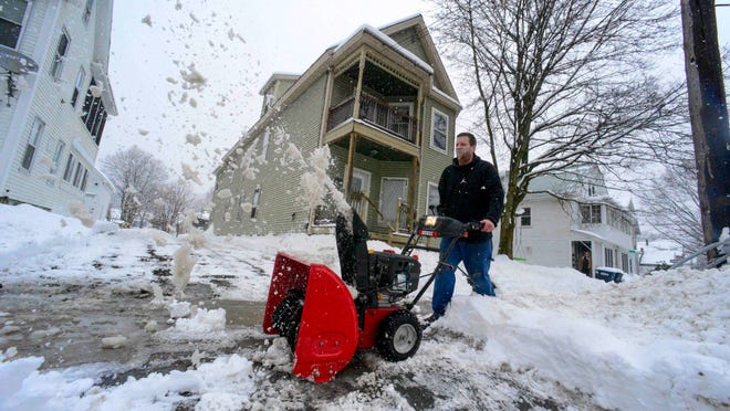

SAN FRANCISCO – Californians were bracing for the latest in an unrelenting wave of strong storms as forecasters warned of another atmospheric river expected to bring an additional round of flooding rainfall, high-elevation snow and strong winds to parts of the state this week.
More than half of California was under either a flood watch or a winter storm warning Sunday as one atmospheric river receded and another one approached.
These long, narrow bands in the atmosphere carry copious amounts of water vapor that get released as rain or snow when making landfall. The upcoming atmospheric river, not expected to be quite as wet as the one from the weekend, will be the 11th to slam the state since late December.
“Definitely prepare for some more flooding impacts,” National Weather Service forecaster Eleanor Dhuyvetter said Sunday. “The ground is very saturated. We’re already seeing some impacts from some light amounts even today.”
Before this parade of storms, California was in the grips of a punishing three-year drought that now seems like a distant memory.
The Big Sur area in the state’s central coast just received nearly a foot of rain over two days. And with another 20 inches of snow dropping at a measuring station in the Sierra Nevada, the snowpack is at its highest in about four decades.
“The weather in California is almost like your spigot outdoors,” AccuWeather meteorologist Bernie Rayno said. “When it’s on, the water flows out and floods. But when it’s off, there will be barely a drop.”
WHAT IS AN ATMOSPHERIC RIVER?These rivers of water vapor can extend thousands of miles
Wind gusts of up to 45 mph will spread across Northern California on Sunday and Monday, AccuWeather said, raising the possibility of downed power lines. Rainfall will intensify Monday into Tuesday, and in upper mountain elevations, meteorologists warn visibility could be near zero.
The combination of more rain and melting of some of the snowpack due to warmer conditions will increase the risk of flooding at lower elevations.
“Considerable flooding impacts below 5,000-foot elevation along the central California coast, San Joaquin Valley, Sacramento Valley and southern Sierra Nevada foothills into Tuesday,” the National Weather Service said.
STORM SLAMS STATE:California storm brings flooding, breached levees and evacuations
More than 8,500 people evacuated
At least two deaths were caused by the latest storm and a third one is being investigated for its links to the weather.
More than 8,500 people were evacuated Saturday in Monterey County, where a levee failed and flooded the unincorporated community of Pajaro, home to about 1,700 residents, a large number of them Latino farmworkers.
YOSEMITE STILL CLOSED:Park won’t reopen until at least St. Patrick’s Day due to winter weather
The Pajaro River separates the counties of Santa Cruz and Monterey in the area that flooded Saturday. Floodwaters that got into the region’s wells might be contaminated with chemicals, officials said, and residents were told not to drink or cook with tap water. Crews have been working to fix the levee.
The rain and snow from the upcoming system, carrying warm subtropical moisture across the Pacific from near Hawaii, is expected to extend from Central California to Oregon, as well as northern Nevada.
California Gov. Gavin Newsom has declared emergencies in 34 counties in recent weeks, and the Biden administration approved a presidential disaster declaration for some on Friday morning, a move that will bring more federal assistance. President Joe Biden spoke with Newsom on Saturday to pledge the federal government’s support in California’s response to the emergency, the White House said.
Contributing: The Associated Press