

Extreme weather is increasingly in the news these days. We’re accustomed to hearing about unusually strong hurricanes, tornadoes and even the polar vortex, but atmospheric events can get a lot weirder—as can the names we give them. Check out these bizarre weather phenomena and their intriguing monikers.
Atmospheric River/Pineapple Express
A 2019 atmospheric river drenches California with heavy rain and mountain snow, triggering flash floods and mudslides. Credit: NOAA
A “river” of water vapor in the sky that can grow to 2,000 miles long, 500 miles wide and two miles deep. Strong winds sometimes push these series of connected rainstorms from midocean areas toward the western coasts of continents. The heaviest atmospheric rivers strike the U.S. and Canada—where they can carry vapor equivalent to 25 times the flow of the Mississippi River and can produce the biggest floods in a century. In 1861 one turned California’s Central Valley into an inland sea 300 miles long and 20 miles wide. Some forecasters call an atmospheric river a pineapple express if it rolls in from the region of Hawaii.
Bomb Cyclone/Bombogenesis
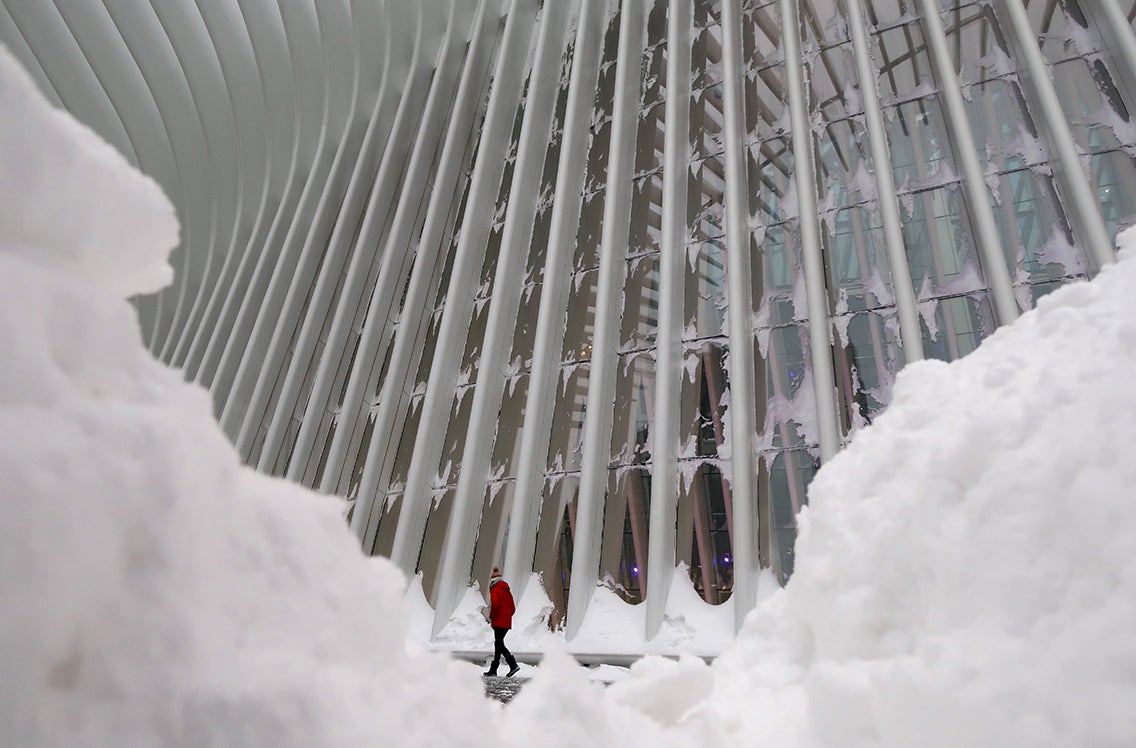 A man walks outside the Oculus transit hub in New York City during a winter “bomb cyclone” storm in January 2018. Credit: Gary Hershorn/Getty Images
A bomb cyclone is a rotating, rapidly intensifying storm that brings heavy rain or snow. It is generated by bombogenesis—when a storm’s barometric pressure plummets by at least 24 millibars in 24 hours, causing the system to “blow up” in strength. The nastiest nor’easters (storms that spin up along the U.S. East Coast and typically result in strong winds over the Northeast) are often caused by bombogenesis.
Derecho
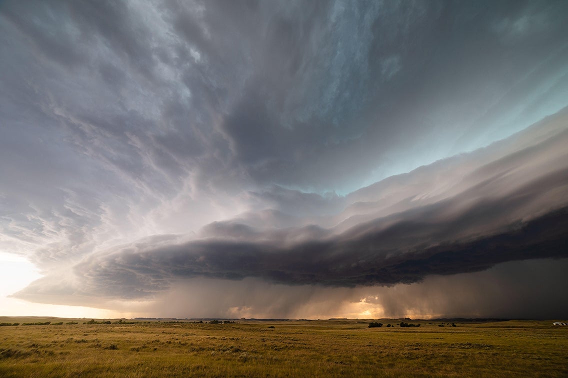 A dramatic derecho moves across eastern Montana. Credit: John Sirlin/Alamy Stock Photo
A widespread, severe and long-lived windstorm that moves rapidly in a straight line, usually driven by thunderstorms. The term derecho—a Spanish word meaning “straight”—designates a storm with gusts of at least 58 miles per hour and “straight-line wind” damage that extends more than 240 miles [see “Straight-Line Wind/Downburst/Microburst” at bottom]. An August 2020 derecho that raced across Iowa reportedly damaged thousands of homes and millions of acres of corn and soybeans, representing a major fraction of the state’s cropland.
Firenado/Fire Whirl
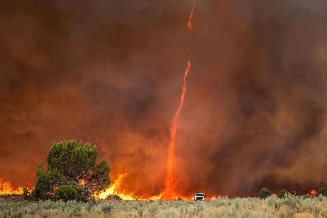 A firenado rises out of intense flames at the Pine Gulch Fire near Grand Junction, Colo., in August 2020. Credit: USFS Photo/Alamy Stock Photo
Spinning vortex of hot air, gases and embers that rises rapidly from an intense wildfire and can carry smoke, debris and flames hundreds of feet into the atmosphere. These whirls range from a few feet to 500 feet in diameter, and the largest ones can carry embers long distances.
Flash Drought
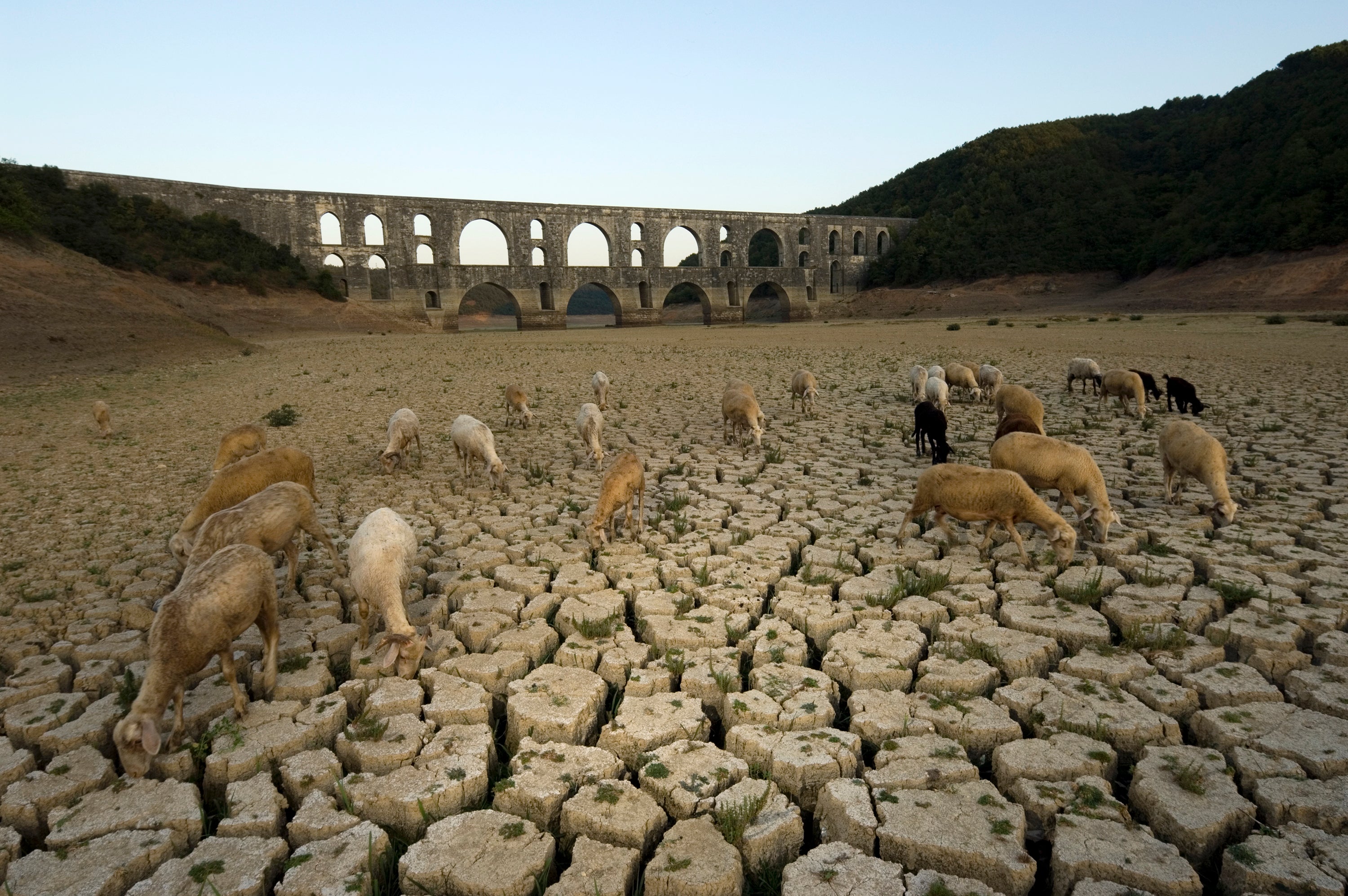 Flash drought parches the earth by the Maglova Aqueduct in Turkey. Credit: HSNPhotography/Getty Images
The rapid onset of drought, triggered by low precipitation, abnormally high temperature, strong winds and searing sun. Flash droughts accelerate evapotranspiration—soil and plants giving up excessive moisture—which can ruin crops.
Graupel
.jpg) Liquid water droplets freeze onto the surface of a snow crystal. When this process continues so that the shape of the original crystal is no longer identifiable, the resulting crystal is referred to as graupel. Credit: Science Source
Liquid water droplets freeze onto the surface of a snow crystal. When this process continues so that the shape of the original crystal is no longer identifiable, the resulting crystal is referred to as graupel. Credit: Science Source
There are soft snowflakes and hard hail pellets. In between, there’s graupel—a kind of soft hail. In uncommon atmospheric circumstances, very cold water droplets aloft freeze onto snowflakes and fall with them, hitting the ground with a squishy plop.
Haboob
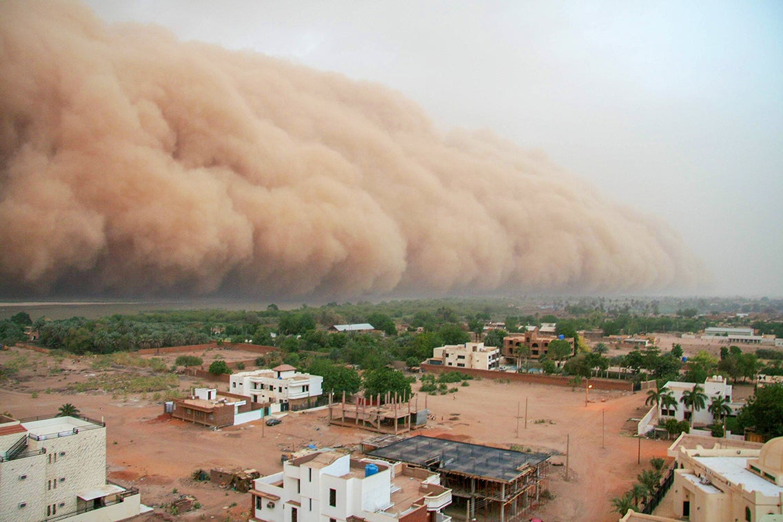 A haboob approaches the outskirts of Khartoum, the capital and largest city of Sudan. Credit: Jordistock/Getty Images
In Arabic this term means “blasting” and it describes a thick, violent dust storm or sandstorm. The word caught on as more intense haboobs have cut across the Middle East, northern Africa and India, grabbing media coverage. Winds can drive dust at up to 60 mph, crippling transportation and infiltrating people’s lungs, even though these events often pass in less than an hour.
Pogonip/Ice Fog
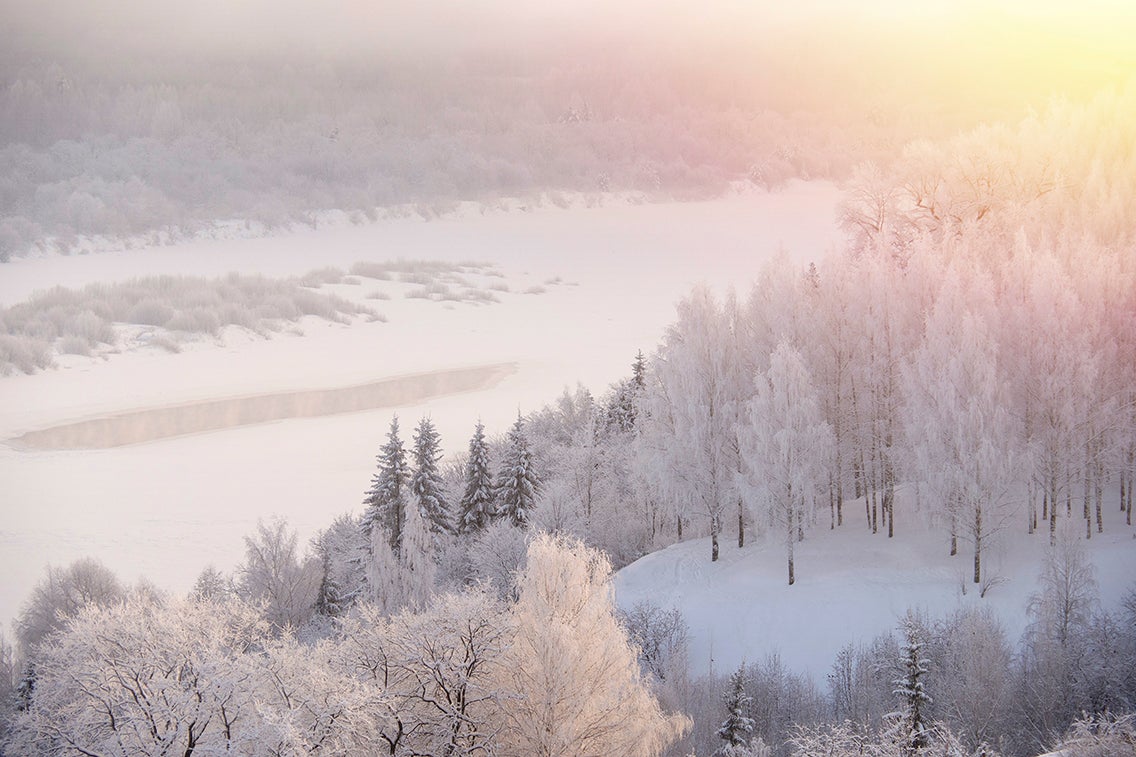 Winter ice fog covers a river and birch grove. Credit: Azovsky/Getty Images
Fog is made of water vapor, yet sometimes ice particles can create the ephemeral mistWhen the air temperature is below freezing and relative humidity is greater than 100 percent—an infrequent combination—these ice crystals can form and hover to form a “pogonip,” or ice fog. Pogonips typically happen in deep mountain valleys. The term is usually credited to the Shoshone peoples: it is said to be derived from the Shoshone word payinappih, which means “cloud.”
Saskatchewan Screamer/Alberta Clipper
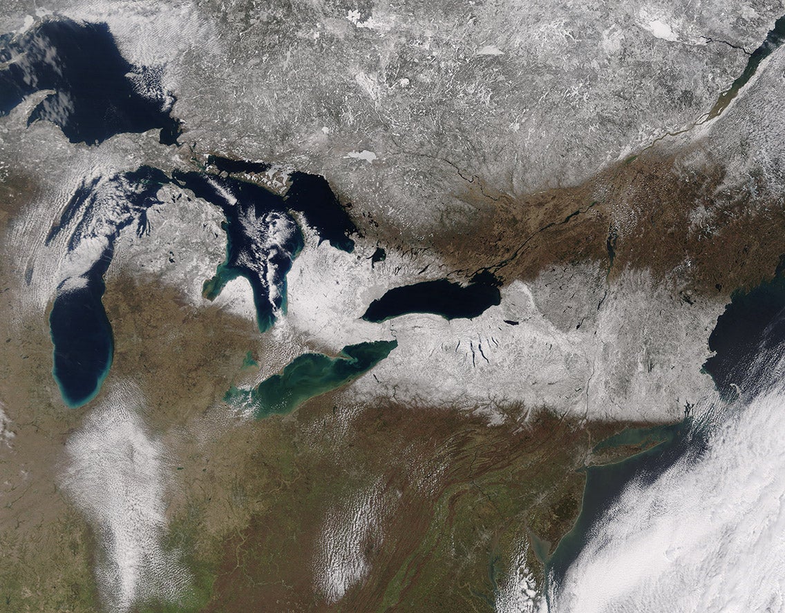 A fast-moving Alberta clipper drops snow across the U.S. Upper Midwest and Northeast. Credit: NASA images by Jeff Schmaltz/LANCE/EOSDIS Rapid Response
A fast-moving, low-pressure weather system that forms when frigid Arctic air drops into Canada’s province of Saskatchewan as moist Pacific Ocean air simultaneously arrives from the west. The resulting collision sets off howling winds that blow southeast toward the U.S. Great Lakes region, whipping up local blizzards and whiteouts even when snowfall totals are modest. When a similar system starts farther west in the province of Alberta, it’s known as an Alberta clipper.
Siberian Express
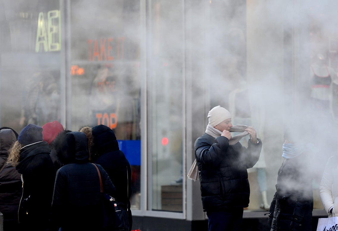 Bitterly cold temperatures delivered by a “Siberian Express” reach Times Square in New York City, setting record lows in many places along the way. Credit: Wang Lei/Xinhua/Alamy Live News
A surge of extremely cold air created by a high-pressure system that develops over Siberia, travels across the North Pole and drops down into Canada or the U.S., causing temperatures there to plunge. Sometimes these systems move directly eastward instead and grip Japan.
Snowmageddon/Snowpocalypse/Snowzilla
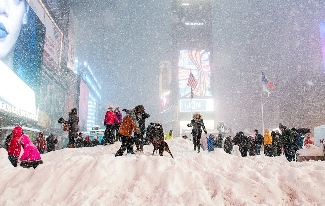 People walk in Times Square during a blizzard in January 2016. Credit: Noam Galai/WireImage/Getty Images
The word “snowmageddon” and its colorful synonyms may be more hype than meteorology. Popular media hasembraced the terms, using them when a snowstorm clobbers an area that usually gets little snow. One famous case was the January 2016 blizzard that struck Washington, D.C., shutting down the city and the federal government for several days. Another “snowpocalypse” befell the city again in February 2010.
Stormquake
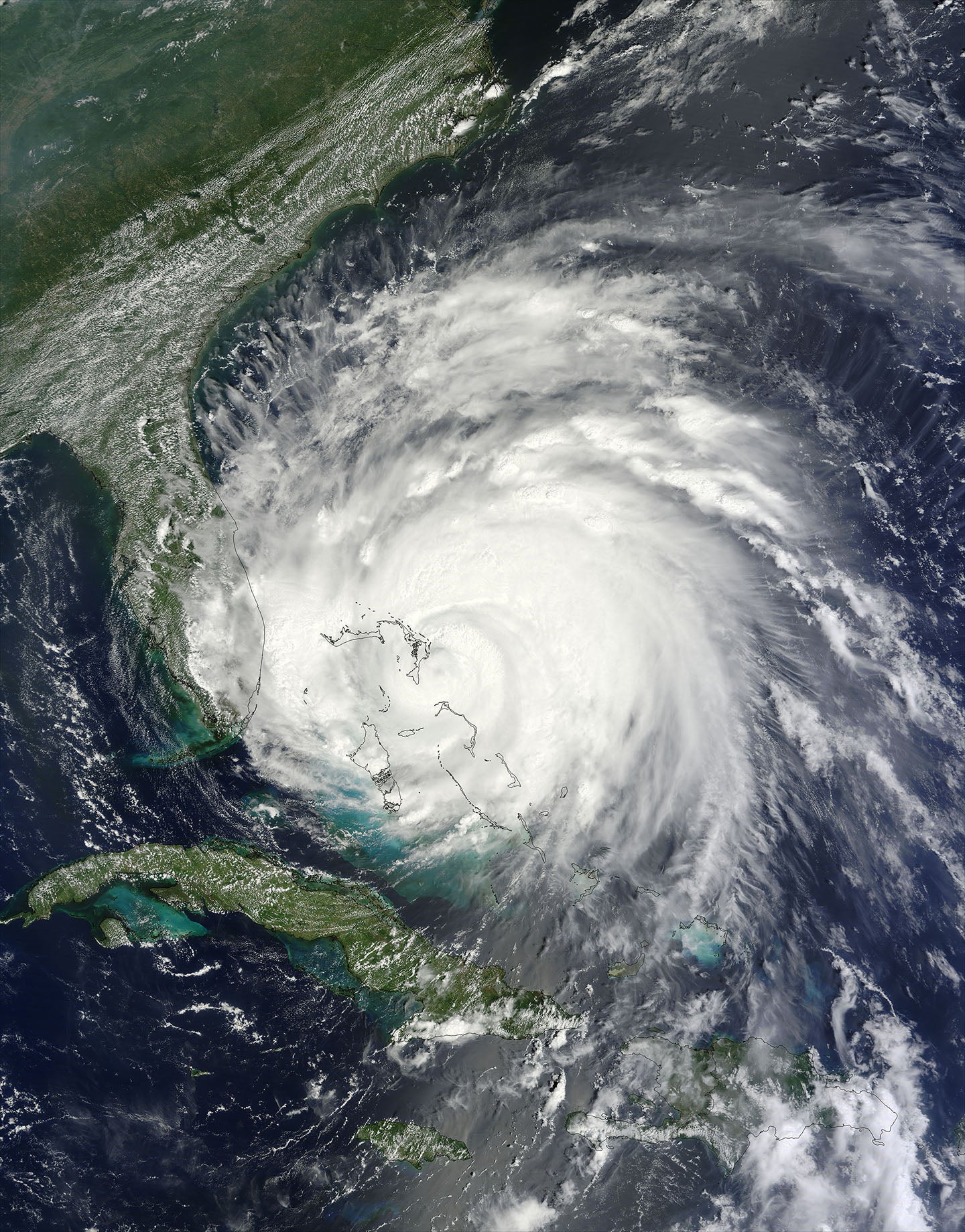 Hurricane Irene moving over the Bahamas in 2011. The hurricane caused stormquakes near Little Bahama Bank, part of the archipelago’s seafloor. Credit: NASA image courtesy of Jeff Schmaltz/MODIS Rapid Response Team, NASA GSFC
Some storms that rage over the ocean, notably hurricanes, can create very large waves that sometimes crash downward into the seafloor. This occasionally sets off vibrations in Earth’s surface similar to those from an earthquake. Although researchers only discovered the phenomenon a few years ago, by studying seismic records and storm tracks back in time, they found that thousands of stormquakes had occurred from 2006 to 2019 near the U.S. and Canadian coasts. Some were as powerful as a magnitude 3.5 earthquake.
Straight-Line Wind/Downburst/Microburst
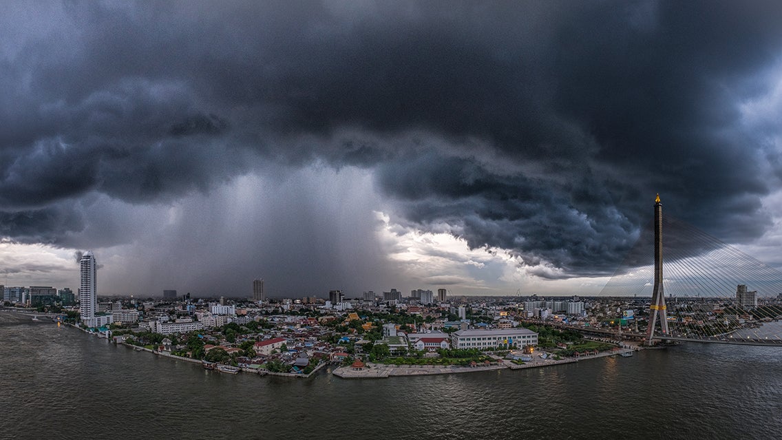 A microburst strikes in Bangkok, Thailand. Credit: Natapat Ariyamongkol/Getty Images
Strong thunderstorms can create tornadoes, but also powerful winds that have no rotation. The latter are called “straight-line wind.” In these cases, the storm draws high-altitude air straight downward. When it hits the ground, this “downburst” fans out in a straight line, with wind that can exceed 100 mph, causing dangerous conditions and property damage. A “microburst” is a highly localized downburst.
Thundersnow
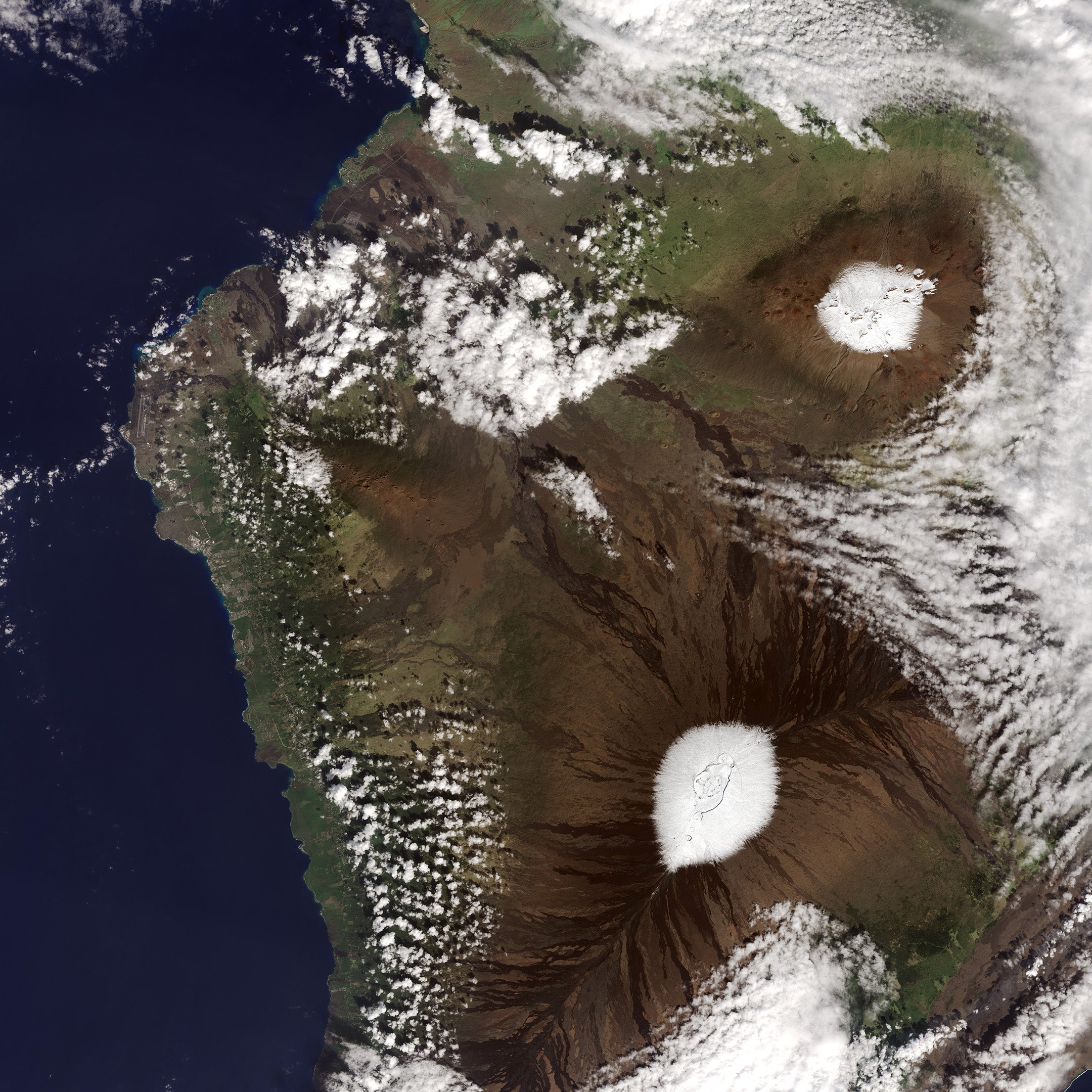 A snowstorm that left snow on Hawaii’s peaks also brought bouts of thunder and lightning. Credit: NASA Earth Observatory images by Jesse Allen, using Landsat data from the U.S. Geological Survey
This word is pretty self-explanatory: it describes a thunder and lightning storm that spews snow instead of rain. But given how strongly people associate thunderstorms with rain, standing in a snowy thunderstorm storm can seem strange.
Williwaw
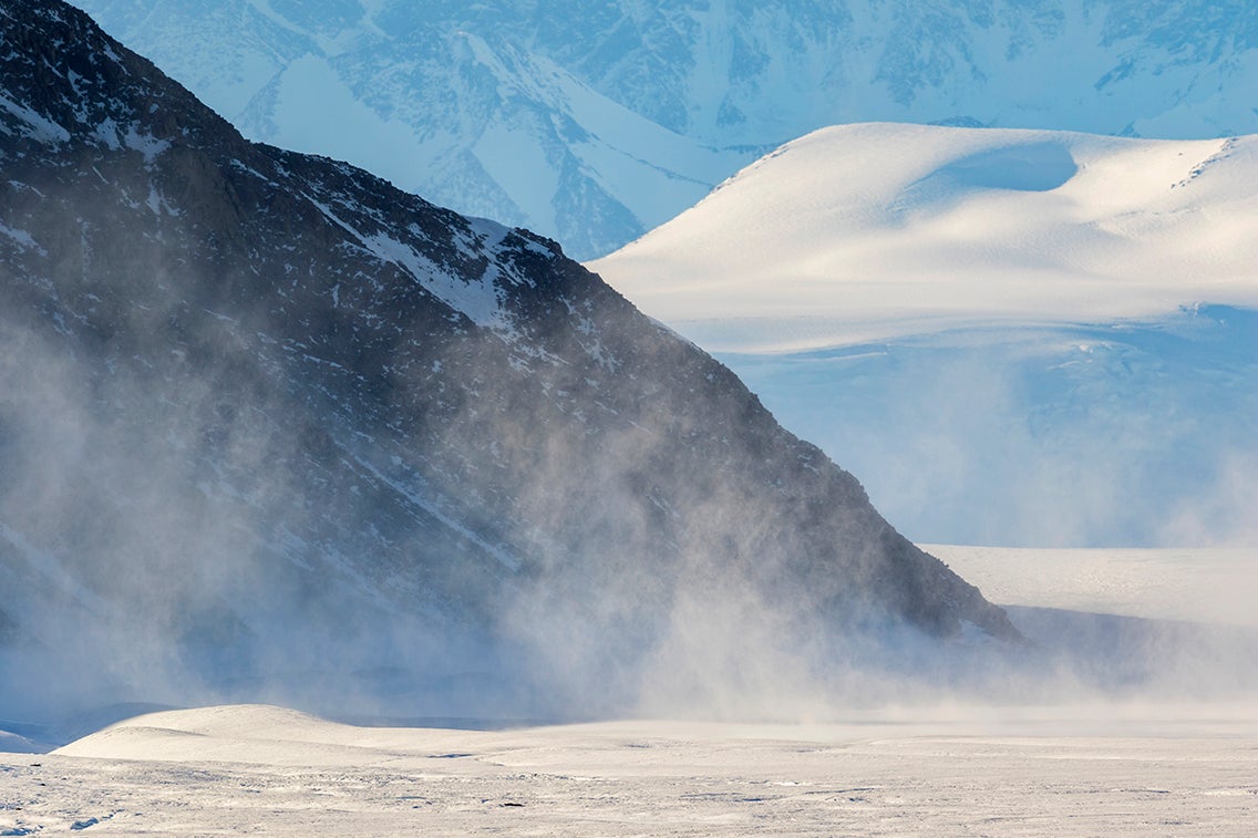 A williwaw blows in Terra Nova Bay, along the coast of Victoria Land, Antarctica. Credit: Andrew Peacock/Getty Images
A sudden, violent gust of cold, dense air that dives down from mountaintops along a coast. This downward blast can roil coastal waters, wreaking havoc with ships. Williwaws occur most often at very high latitudes, such as the Aleutian Islands off Alaska and the Strait of Magellan at Chile’s southern tip. Gore Vidal’s first novel was Williwaw, which he wrote while stationed on a U.S. Army supply ship in the Aleutian Islands.